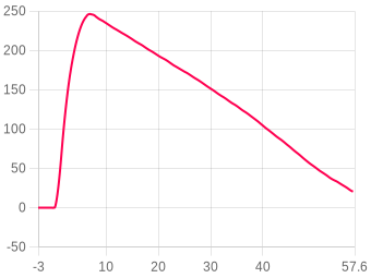
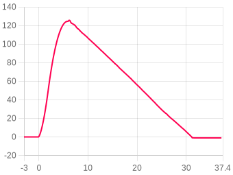
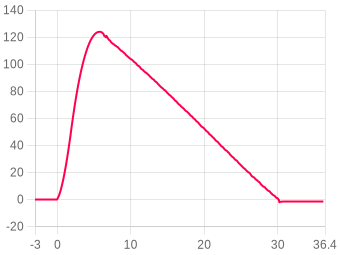
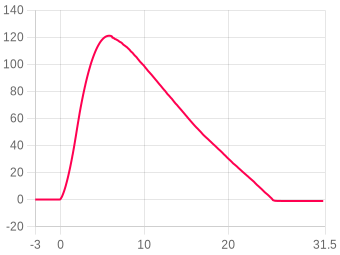
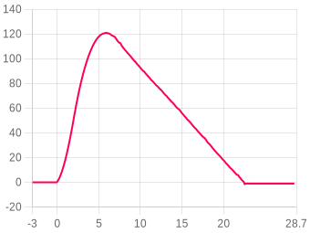
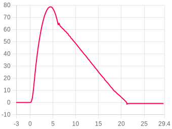
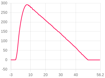
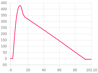
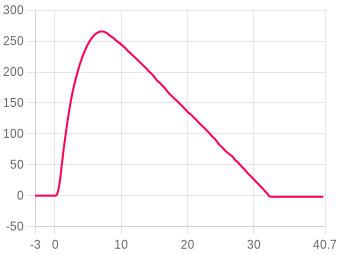
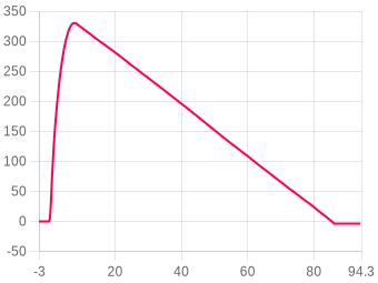
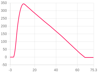
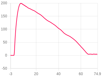
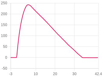
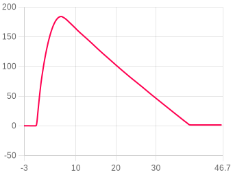
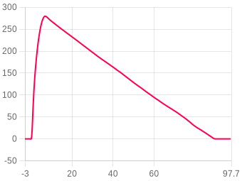
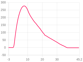
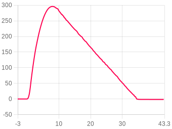
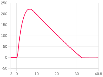
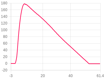
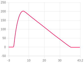
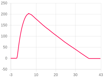
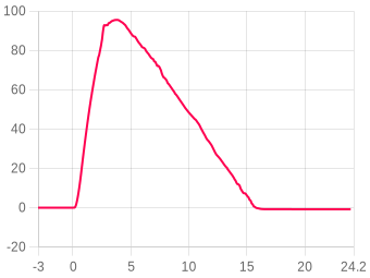
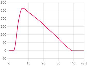
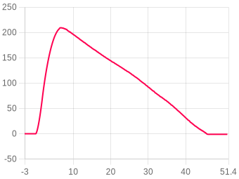
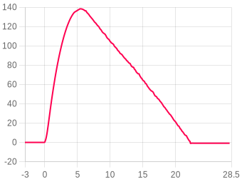
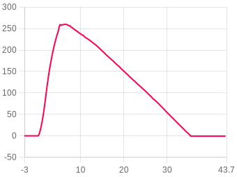
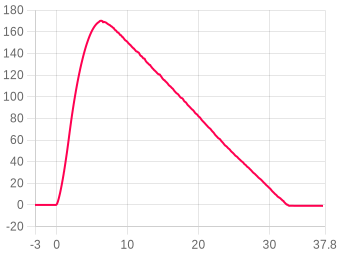
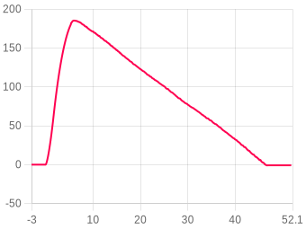
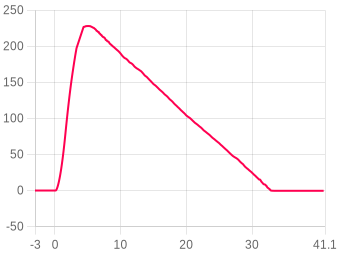
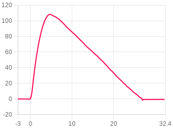
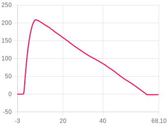
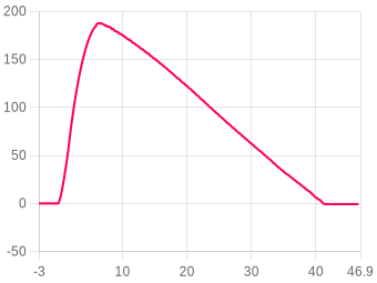
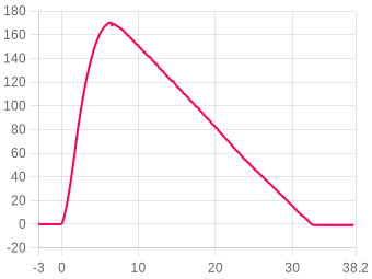
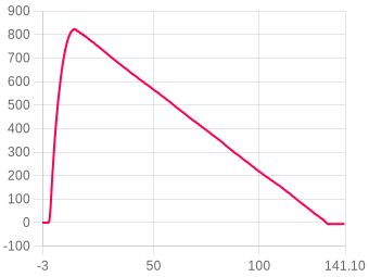
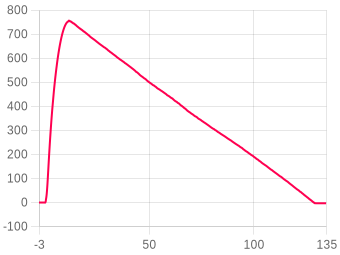
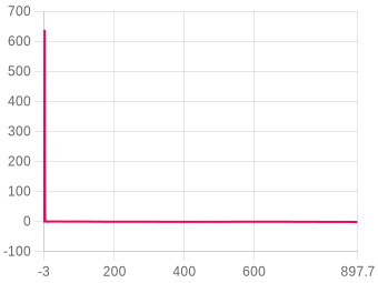
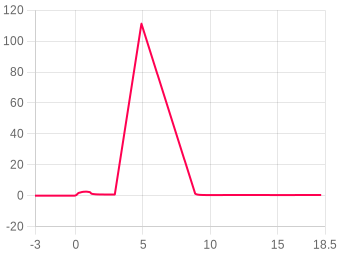
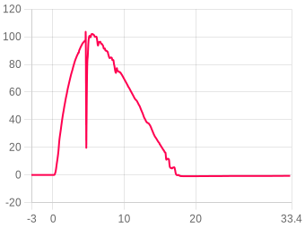
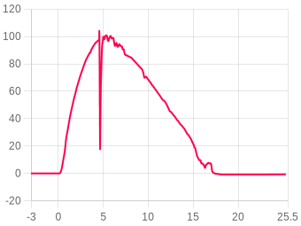
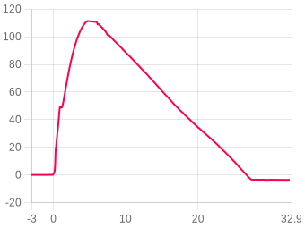
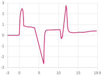
Odległość
Wybierz jednostkę odległości: Metry(m), Stopy(ft), Mile(mi) lub Kilometry(km)
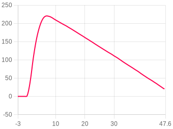
Prędkość
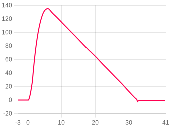
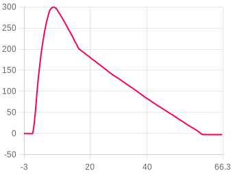
Wybierz jednostkę prędkości: m/s, ft/s, mph lub km/h
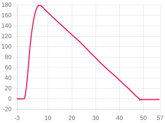
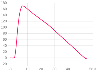
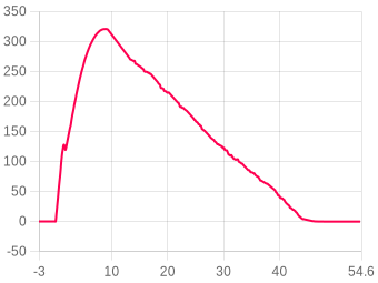
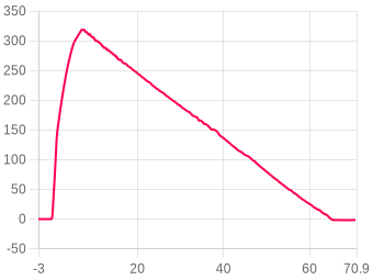
Przyspieszenie
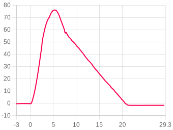
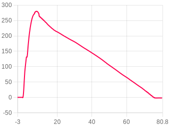
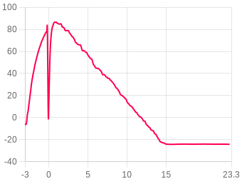
Wybierz jednostkę przyspieszenia: m/s² lub G

1940 Exploratory Planetary Cargo Ferry flight 12

Nano V1 Rev 4 · firmware 1.65Secure logSecure logThe altimeter signed this log and it passed verification on upload, so the data is unchanged since the device wrote it.Signatures use Ed25519, which no current technology can forge.
Apogeum
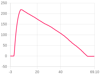
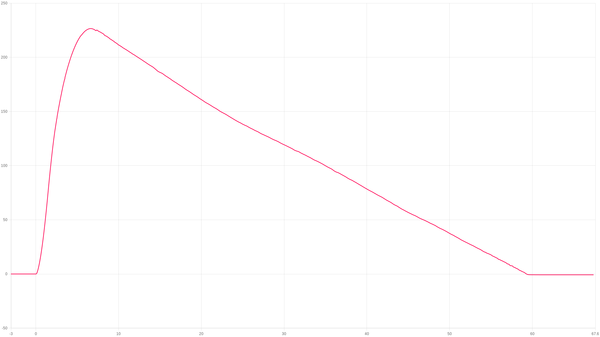
226.59m
6.65 s after launch
Maks. wznoszenie
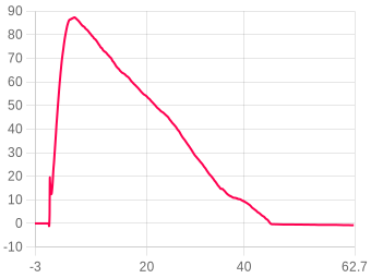
81.11m/s
peak ascent
Maks. podczas spalania
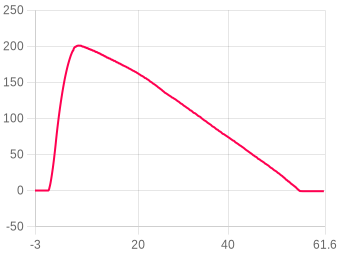
18.46G
during the burn
Lądowanie
59.26s
touchdown 4.05 m/s
ZOOM TO
s
s
Pokaž zdarzenia
Dostosuj temp. & ciśnienie ?
Obraz
Powiększenie
Kliknij i przeciągnij lub užyj gestu
Porównaj lot ?
Something look wrong with this flight's data?
Tell us what looks wrong and we'll look into it. It helps us find and fix problems in the firmware and on the site, and we can correct this flight.
You're not logged in, so we can't let you know when we've looked into it.
Podsumowanie lotu

The flight, moment by moment

Liftoff
0 s
Kąt rampy7.8°
Zejście z rampy5.56°
Launch detected
0.847 s
Wysokość30.05 m
Prędkość58.76 m/s
Wypalenie (pierwszy)
1.5 s
Wysokość77.23 m
Prędkość80.920 m/s
Apogeum
6.65 s
Wysokość226.59 Metry
Maks. nachylenie do wypalenia7.78°
Možliwy wyrzut
6.807 s
Wysokość226.39 m
Prędkość-1.87 m/s
Lądowanie
59.26 s
Wysokość0.09 m
Maks. opadanie-7.26 m/s

Stabilność88.8%Doskonały

Nachylenie przy wypaleniu (20%)80.3
20% · Rail angle 7.8°
Prędkość pochylania/odchylania (30%)95.6
25% · Coning 21.4/24.8°/s
Coning · boost (25%)94.1
25% · Spin 23.8°/s
Prostoliniowość ciągu (15%)84.5
30% · Thrust 96.7%

Rocket information

Calculated from the flight data alone
Boost acceleration53.9 m/s²
average over the burn · 5.5 g
Coast deceleration15.7 m/s²
average · gravity plus drag
Ballistic coefficient110 kg/m²
fitted to the 5.15 s coast
Apogee lost to tilt0.53 m
flown vertical ≈ 227.1 m · from the tilt at burnout
Chute opening peak49.62 G
largest deceleration after ejection
Average descent rate4.31 m/s
ejection to landing · 52.45 s
Bateria & temperatura 65% → 61% · Temperatura początek 41.86 → 40.9 °C · Start po włączeniu 14m 56s

About the stability score

Worked out from the flight log between liftoff and 80% of apogee. It is independent of the angle the altimeter was mounted at, so it measures the flight rather than the fitting.

Nachylenie przy wypaleniu (20%)20%How close to vertical it left the rod.
Prędkość pochylania/odchylania (30%)25%How much the nose swung off the rocket's own axis across the whole ascent.
Coning · boost (25%)25%The same swing during the burn, when it matters most.
Prostoliniowość ciągu (15%)30%How cleanly the motor pushed along the body.

Spin about the rocket's own axis is not counted against it — a fast, straight spin is stable. The figures beside the score are the raw measurements behind these four.

Wysokość
Apogeum226.59 Metry
Czas do apogeum6.65 s
Wysokość wypalenia77.23 m
Wys. maks. prędkości74.67 m
Wys. wyrzutu226.39 m
Wys. lądowania0.09 m
Wysokość nagrywania1308.31 m
Prędkość
Maks. wznoszenie81.11 m/s
Maks. opadanie-7.26 m/s
Przy wypaleniu80.920 m/s
Prędk. opadania-4.319 m/s
Prędk. wyrzutu-1.87 m/s
Prędk. lądowania-4.047 m/s
Przyspieszenie
Maks. podczas spalania18.46 G
Maks. wznoszenie18.46 G
Maks. opadanie49.62 G
Śr. wznoszenie0.97 G
Śr. spalanie5.52 G
Czasy
Wypalenie (pierwszy)1.5 s
Apogeum6.65 s
Možliwy wyrzut6.807 s
Lądowanie59.26 s
Kąty
Kąt rampy ?7.8° ± 0.3°
Zejście z rampy ?5.6°
Maks. nachylenie do wypalenia ?7.78°
Orientacja ?15.23°
Przesunięcie montażu ?3.9°
Przechylenie startowe-9.72°
Pochylenie startowe-11.78°
Maks. obrót (spal.)195.16 dps
Śr. obrót (spal.)39.65 dps
Staging
Stages detected1
Burnout (refined)1.543 s
Stage S1 burnout
flip1.497 s
drag1.543 s
sig1.648 s
Recovery
Single deploy
No dual deploy detected on this flight.
Ogólne
Data przesłania24/10/26-21:34:46
Próbki danych11073
Całkowity czas nagrania76.205 s
Śr. próbki/s145.3
Liczba blokad0
Start po włączeniu14m 56s
Oś referencyjnaX
Bateria & temperatura
Bateria początek65%
Bateria koniec61%
Temperatura początek41.86°C
Temperatura koniec40.9°C
Something look wrong with this flight's data?
Tell us what looks wrong and we'll look into it. It helps us find and fix problems in the firmware and on the site, and we can correct this flight.
You're not logged in, so we can't let you know when we've looked into it.
Notatki užytkownika
Brak notatek
Dodaj to urządzenie do swojego konta, aby edytować
Film Youtube
Brak filmu
Dodaj to urządzenie do swojego konta, aby edytować
Zdjęcia lotu 0
Brak zdjęć
Flown as
Rocket
None
not linked
Motor configuration
Custom
1× Estes C6-5, set on this flight
Loaded weight
81.4 g
estimated, none entered

Measured burn

from this flight’s thrust
Total impulse, NFPA 1125needs the weight
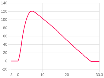
rated 8.82 Ns
Burn time, NFPA 11251.52 s
0.00 to 1.52 s
Peak thrustneeds the weight
at 0.14 s
With no loaded weight the impulse would only give the motor’s rating back, so it waits for the weight. The burn time is measured either way.
Silniki lotu
1st stage · 5s delay
1×C6-5EstesDetails
Burn time
1.86 s
Diameter
18.00 mm
Average thrust
4.74 N
Max thrust
14.09 N
Total weight
24.10 g
Propellant weight
10.80 g
Propellant type
black powder
Impulse8.82Ns
Max thrust14N
Burn time1.86s
Impulse classC
1st stage thrustloading curve…
Motor data by ThrustCurve.org
Dodaj to urządzenie do swojego konta, aby edytować
Powiązana rakieta
Žadna rakieta nie jest powiązana z tym lotem

Linked flights

Connect flights that belong together: a second altimeter flown in the same rocket, or the same rocket flown again. Linked flights appear on each other’s pages.

No linked flights yet.

Miejsce startu, data i godzina

Kliknij na mapę, aby oznaczyć miejsce startu. Przełączaj między widokiem mapy i satelity.

Imagery © Esri, Maxar, Earthstar Geographics

Kliknij na mapę · Przeciągnij, aby dostosować

Canopy height from the Meta and WRI High Resolution Canopy Height Maps v2 (Meta and World Resources Institute, 2026; source imagery © 2016 Vantor), used under CC BY 4.0. Ground elevation built from Terrain Tiles (Mapzen and AWS Open Data), derived from 3DEP and GMTED courtesy of the U.S. Geological Survey, SRTM courtesy of NASA, and ETOPO1 courtesy of NOAA. Map and imagery credited on the view above.

Site namePlayas Training Center - NSL WestLat31.943667Lng-108.548579Ground level1350.8 m · 4432 ftData startu2026-10-24Godzina startu10:30
Animacja danych lotu

FLIGHT 3160

226.59 Meters

ALTITUDE
0.00m
VELOCITY
0.00m/s
ACCEL
0.00G
TILT
0.00°
PITCH
0.00°
ROLL
0.00°
YAW
0.00°
TIME
0.00s
AWAITING LAUNCH
ALT
altimetercloud.com
LAUNCH T+0.00s LANDING

BURNOUT

Motor burn complete

Uwaga: Animacja lotu wymaga montażu wysokościomierza w stałej orientacji. Skalibruj czujniki dla najlepszych wyników.
Nano V1
Rocketry Ltd

Nano V1

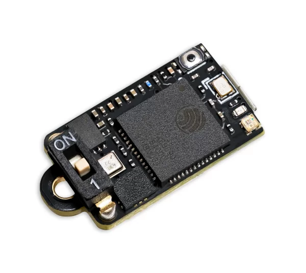
Kompaktowy altimetr do małych rakiet. Ten lot został wykonany na Nano V1.
Wersja sprzętu Rev 4Wersja oprogramowania 1.65Ostatnio online 24/10/26-21:34:46

Specyfikacja

Elektronika

Mikrokontroler
ESP32-S232-bit ESP32-S2 240MHz
Akcelerometr
ST LSM6DSO3232G 3-axis (SPI)
Barometr
Bosch BMP581300 to 1250 hPa within specification
Żyroskop
ST LSM6DSO322000 dgps 3-axis

Rejestracja danych

Maksymalna częstotliwość próbkowania
833 Hz
Maks. liczba próbek w zapisie
38,000
Najdłuższy zapis
1 h 3 minAt 10Hz although default settings are 433Hz with 1:8 hybrid mode

Elektronika

Mikrokontroler
ESP32-S232-bit ESP32-S2 240MHz
Akcelerometr
ST LSM6DSO3232G 3-axis (I2C)
Barometr
Bosch BMP581300 to 1250 hPa within specification
Żyroskop
ST LSM6DSO322000 dgps 3-axis

Rejestracja danych

Maksymalna częstotliwość próbkowania
833 Hz
Maks. liczba próbek w zapisie
38,000
Najdłuższy zapis
1 h 3 minAt 10Hz although default settings are 433Hz with 1:8 hybrid mode

Wymiary, waga i bateria

Wymiary
20 × 10 × 8.9 mm
Waga
1.65 g1.65 g z najmniejszą baterią
Napięcie baterii
3 do 4.2 V
Czas pracy na baterii
5na najmniejszej baterii
Wymiary
20 × 10 × 8.9 mm
Waga
1.65 g1.65 g z najmniejszą baterią
Napięcie baterii
3 do 4.2 V
Czas pracy na baterii
5na najmniejszej baterii

Dokumenty

Flights from this altimeter

7 of 720 of 117
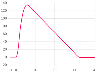
Settings, as they were for this flight

Ogólne ustawienia lotu
Ciśnienie prognozowane
i
Set this to your local forecast pressure at sea level. This will offer you slightly improved accuracty for your flight, although it's not 100% essential every little helps!

Xcweather.co.uk is a decent place to grab pressures from for your location and time.
1013.2 mbar
Detekcja startu
i
This is the altitude above the launch pad altitude where the altimeter will trigger itself into recording / flight mode.

The altimeter keeps a constant average of the pressure while waiting for launch, it uses a simple algorithm and the pre-flight buffers to do this. The most recent 120 samples (~4 seconds) are ignored so your pre-trigger altitude won't effect the ground baseline.

For almost all uses we suggest keeping this on the 25 Meter (~82 feet) default settings. If you want to test your altimeter by throwing it in the air, or are planning a very low flight you may want to lower the setting.
30 meters
Sample ratio
i
The altimeter runs at 50Hz however you can record every sample or every X samples in order to extend the log time. For example if you set the ratio to 1 it will save 1:1 samples, or if you set it to 3 it will save 1 in 3 samples.
1:1:1 (400Hz)
Max samples
i
This is the maximum samples the altimeter will log per flight. When it reaches this amount it will stop and save the recording.
38000
Recording stop
i
This setting is how the altimeter decides to stop recording. You can choose either 450 (~9s) or 900 (~18s) samples stable or it will record until the max samples limit unless you press the BUTTON in Manual stop mode.

The samples stable method waits for the devices altitude not to change for the set number of samples. This is defined by not changing by more than +/- 1.0 meters for 98% of the samples, it's a reliable method to stop the recording after landing within 8-10 seconds (300 sample) or 16-20 seconds (600 sample).
Auto: 8s stable altitude
Oversampling
i
Oversampling is a internal setting of the BMP 390 pressure sensor. It is how many samples are taken for each reading. By taking multiple samples for each pressure reading the altimeter reduces noise and increases the resolution of the output.

The sensor can run at 50 samples per second in 4X mode, so we suggest leaving it in this mode as it will offer the highest accuracy.
16x Oversampling
IIR filter
i
The IIR filter is another internal sensor for the BMP390 pressure sensor. It is a Infinite impulse response filter used to enhance pressure measurement accuracy by reducing noise. It's primarily for smoothing out rapid pressure changes.

We suggest not setting this too high as it will cause delay to changes in altitude if set very high.
COEFF 7
Pressure filter
i
This filter is a software Kalman filter that runs on the altimeters processor.

The Kalman filter uses a prediction step based on a system model and then a correction step using new measurements to refine its estimate, it creates accurate most certain results from data with noise in it.
TruePath
Sample speed
i
The sample rate of the altimeter's sensors. 50Hz takes 50 samples per second, 100Hz takes 100 samples per second for higher resolution data.
400 Hz
Hybrid mode
i
When enabled, the altimeter records at full speed during ascent then switches to half speed after apogee to extend recording time during descent.
Enabled
Sync sensors
i
The filters on the pressure sensor can cause it to lag very slightly behind the Accelerometer and Gyroscope data. The Sync sensors option detects how far out of sync these sensors are. It then corrects the Acceleration and Gyroscope readings to match the pressure sensor.
WŁĄCZONY (46 samples / 114.88ms)
Orientation
i
This is the orientation you intend to install the Altimeter in your rocket. It's needed to ensure completly accurate angles and orientation charts and reports. Check out the Manual for more information on this.
Down (text up)
IMU filter
i
The IMU filter, or fusion filter takes the data from each axis of the Gyroscope and Accelerometer to calculate the Pitch, Roll, Yaw and tilt angle from vertical. These filters can build up some discrepency over time so it's important to calibrate your sensors to minimise this.
Madgwick 6-Axis
Launch ALP
i
This is prevention against accidental launch detection.

With this disabled the launch is based only on pressure and something that creates a low pressure can trigger the flight by accident. For example pulling your nose cone off can even trigger it.

With this enabled the rocket also needs to have seen 8 samples (0.25 seconds) of acceleration above this setting in the last 3 seconds as well as the pressure drop to trigger. There is a backup trigger of 1.05 seconds of altitude being above the launch detect setting too.

There are very few situations where this option would cause issues, so we suggest leaving it on.
2.0G
Launch lock
i
When enabled, the altimeter locks out recording for a set period after power on to prevent false triggering during setup.
DISABLED
Static temperature
i
A fixed temperature value used for altitude calculation when the external temperature sensor is disabled or not connected.
15 °C
Kalibracja czujników
Przesunięcia kalibracji użyte w tym locie.
Gyroskop⚠ Gyroskop nie został skalibrowany
X0.000°
Y0.000°
Z0.000°
Akcelerometr⚠ Akcelerometr nie został skalibrowany
X0.000 mG
Y0.000 mG
Z0.000 mG

Files

Where the altimeter signs its log, the file carries that signature and a tick beside it. A tick means the data is unchanged since the device wrote it, which is what a record claim needs.
CSV
3160.csv ✓ SIGNED
The log as columns of text. Opens in a spreadsheet, and in every simulator that reads flight data.
1043 KB
LOG
3160.aclz ✓ SIGNED
The altimeter's own compressed log, exactly as the device wrote it. This is the file to keep for a record claim.
138 KB
WX
3160_weather.json.gz
The weather for 48 hours either side of the launch, within 15 km of the launch site: NOAA GFS every hour, at the surface and up to about 31 km, and the NOAA GEFS ensemble where this site holds it. JSON, gzip compressed. Weather data by Open-Meteo.com (CC BY 4.0) and NOAA. For 2026-10-24 10:30 local time at 31.9437, -108.5486.
1392 KB
Pobierz
Adjusted CSV2904 recalculated in your browser
The log recomputed for your own sea-level pressure and temperature. Columns: time, altitude as recorded and adjusted, raw altitude as recorded and adjusted, pressure.

This file is built here from the signed log, so it carries no signature of its own. Anyone verifying a claim should be sent to the flight page and build their own from the original.

Custom CSVbuilt in your browser
Pick any of the chart’s data sets, the worked-out ones included, and the part of the flight to cover. Values come in the units the chart is set to.
In the file
Time span

One row for every time any chosen data set has a sample. A data set with no sample at that time is left blank rather than filled in. Built from the chart’s data, so it carries no signature.

Zaloguj się aby komentować.